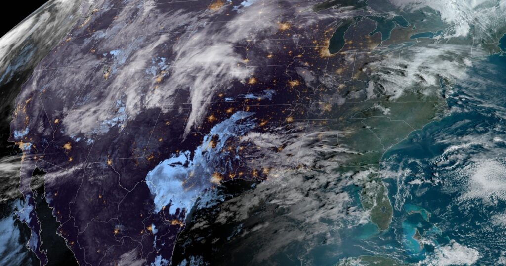

A weather whiplash type of day is in store as a major snowstorm is taking shape over the Rockies, severe thunderstorms across the Plains and there’s an extreme risk for wildfires for parts of Texas and Oklahoma.
On Wednesday morning Winter Storm Warnings were up for 5 million people, ahead of what could be Denver’s biggest snowstorm of the season so far.
Denver will see rain with embedded thunderstorms and temperatures near 50 degrees through midday before crashing into the low 30s with that rain changing to snow around the evening rush hour.
Once the snow starts across the I-25 corridor, it will last through Friday morning with snowfall rates of 1 to 3 inches per hour at times. The heavy snow combined with wind gusts up to 40 mph will make travel nearly impossible.
The I-25 corridor could divide the more blockbuster snow totals of 2 to 4 feet to the west from 4 to 12 inches to the east.
- West of I-25: Total snow accumulations of 1-2 feet with localized totals up to 4 feet especially for the eastern slopes of the Front Range.
- East of I-25: Lesser amounts will be possible here, with generally 4 to 10 inches the most likely scenario with locally higher amounts of up to 8to 16 inches especially along the Palmer Divide which is just east of the Denver metro.
This is a complex forecast for the Denver metro area, specifically, when it comes to how much snow they will see. Regardless of the amounts, the snow beginning around the evening rush hour tonight and continuing through the morning rush hour tomorrow will likely cause major travel issues.
Denver’s largest snowstorm of the season was back in late October, when they picked up 7.5 inches. If they end up picking up snowfall totals in the double-digits, it could be their biggest snowstorm in three years.
Significant snowstorms in March are common for this part of the country. Two of the four heaviest snowstorms on record in Denver happened in mid-March.
As the snow is picking up in intensity across the Rockies, severe storms will be igniting at the same time across portions of the central Plains.
Four million people are under the risk for severe storms Wednesday into Wednesday night across parts of northeastern Kansas, northern Missouri and extreme southern Nebraska.
Very large hail up to tennis-ball sized will be the main risk, followed by isolated tornadoes. Kansas City and Topeka are the main metro areas at risk.
On Thursday as the storm system shifts east, 21 million people will be at risk along an 850-mile stretch from northern Illinois down to northeast Texas.
Very large hail will be the main risk especially across eastern Oklahoma and western Arkansas. Isolated tornadoes and damaging winds will also be possible. Cities to watch include St. Louis, Little Rock and Dallas.
South of where the severe storms are expected to occur, wildfires will be a major threat today for the southern Plains.
The Storm Prediction Center used strong language in their fire weather outlook Wednesday, indicating a critical to extreme fire danger may lead to a ‘wildfire outbreak’ with several wildfires sparking today.
The ingredients leading to the high wildfire concern today include:
- Sustained winds of 30 mph, with gusts to 50 mph or higher.
- Relative humidity in the single digits.
- Very dry fuel, where the fuels (grasses) are even drier than they were before the major wildfire outbreak in late February that sparked the historic Smokehouse Creek Fire.
The extreme fire danger includes areas scorched by the Smokehouse Creek Fire. While that area has already been burned over, other areas including around the heavily populated cities of Amarillo and Lubbock were untouched by that series of wildfires, making those areas more vulnerable because there is ample dry fuel around to burn.
Amarillo, Lubbock and Roswell, New Mexico are cities under the Red Flag Warnings on Wednesday.

Khamrah by Lattafa for Men - 3.4 oz EDP Spray
4% Off
Ghost Sweetheart Eau de Toilette | Pineapple, Jasmine and Sandalwood | Perfume for Women 50 ml
50% Off
Marc Jacobs Dot Eau De Parfum for Women, 100 ml
42% Off
Ted Baker W Eau de Toilette for Her, Fig Leaf, White Peony and Violet Top Notes, Pink Orchid and Raspberry Middle Notes, 75ml
£11.77 (£15.69 / 100 ml) (as of 21/05/2026 03:17 GMT +01:00 - More infoProduct prices and availability are accurate as of the date/time indicated and are subject to change. Any price and availability information displayed on [relevant Amazon Site(s), as applicable] at the time of purchase will apply to the purchase of this product.)
Ted Baker Woman Pink Eau de Toilette Spray Floral Green Feminine Fragrance, Opening Notes are Fresh Peach, Bergamot and Tangerine with Warm Musk, Vanilla and Vetiver Base, 100ml
11% Off
Vera Wang Princess Eau de Toilette - 30 ml

Choco Musk 50ml Eau De Parfum for men and women | Chocolate Musk by Jannat Aromas
17% Off
Christina Aguilera Signature Eau de Parfum (50ml) Floral, Fruity & Exotic Scent, Luxury Fragrance for Women
9% Off
Calvin Klein - Eau De Toilette CKIN2U - Calvin Klein Women, Ladies Perfume, Women's Perfume, Calvin Klein Perfume, Calvin Klein One - 150 ml
5% Off
Jimmy Choo Flash Eau de Parfum, 60 ml (Pack of 1)
3% Off
Fruit of the Loom Men's Heavy T Shirt, White, XL UK
28% Off
ATNKE LED Lighted Beanie Cap,USB Rechargeable Running Hat Ultra Bright 4 LED Waterproof Light Winter Warm Gifts for Men and Women/Pink
17% Off
Men's 1/4 Zip Pullover UK Sale Clearance, Fleece Sweatshirt Casual Jumper Long Sleeve T-shirt Top Stand Collar Sweater Plain Pullover Sports Leisure Workwear Quarter Zip Sweater Lightweight Jumpers
£5.88 (as of 12/11/2025 00:52 GMT +01:00 - More infoProduct prices and availability are accurate as of the date/time indicated and are subject to change. Any price and availability information displayed on [relevant Amazon Site(s), as applicable] at the time of purchase will apply to the purchase of this product.)
Crevice Cleaning Brush, Bathroom Tile Groove Gap Cleaning Brush,Premium Crevice Cleaning Tool Aluminum Support with 15° Angle Magic Brush, Thin Brush for Home Kitchen
19% Off
Wireless Earbuds, Bluetooth 5.3 Headphones in Ear with HiFi Stereo Deep Bass, 4 ENC Noise Cancelling Mic Wireless Earphones 40H Playtime, Bluetooth Earbuds Dual LED Display, IP7 Waterproof, USB-C
42% Off